• Directory
  • CALS Statewide Locations

  • Directory
  • CALS Statewide Locations

Skip to main content
UF Institute of Food and Agricultural Sciences logo
Give      University of Florida
Resources
  • Directory
  • CALS Statewide Locations
Toggle Search Form
GIVE UNIVERSITY OF FLORIDA
  • HOME
  • About Us
        • Overview
        • Vision,Mission & Core Values Statement
        • Map and Direction
        • FLREC History


  • Directory
        • Faculty
        • Staff
        • Graduate Students
        • Faculty Emeritus


  • Research
        • Aquatic Plant Management
        • Entomology and Nematology
        • Environmental Horticulture
        • Forest, Fisheries and Geomatics Sciences
        • Microbiology and Cell Science
        • Plant Pathology
        • Wildlife Ecology & Conservation
  • Teaching
      •  
      • Academic Programs
      • Course Offerings
      • Student Resources
      • Student Housing Application        
      • FLREC Housing Policy/Guidelines
  • Extension
        • Aquatic Plant Management
        • Entomology and Nematology
        • Environmental Horticulture
        • Plant Pathology
        • School of Forest, Fisheries and Geomatics Sciences
  • 2025 Hurricane Plan

      2025 Hurricane Plan

Fort Lauderdale Research and Education Center

Fort Lauderdale Research and Education Center

Dr. Hartwig Henry Hochmair: Research:

Spatial Analysis and GIS

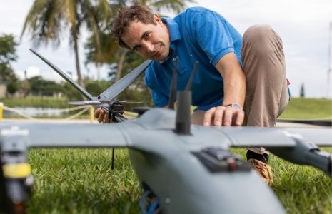
Dr. Hochmair’s research focuses on the spatial analysis of geographic information to address key issues of sustainable transportation, quality control of crowd-sourced geodata, and the spread of invasive species. He uses Geographical Information Systems (GIS) to quantify how the layout of multi-modal transportation networks affects travel behavior, how improved network design can make transportation more sustainable, and how crowd-sourced geodata, such as shared geotagged images or tweets, can be used to better understand travel behavior in urban and rural environments. Furthermore he analyzes how crowd sourced spatial data, such as OpenStreetMap, can supplement governmental and commerical spatial spatial datasets for mapping and navigation purposes, i.e. for bicycle trip planning. Dr. Hochmair collaborates with researchers from other departments at the FLREC, such as Entomology, to answer displine specific research questions using GIS analysis. This includes, for example, the identification and modeling of spatial dispersal patterns of invasive termites in Florida.
Professor

3205 College Avenue
Davie West, Room 224
Davie, FL 33314
Phone: 954-577-6317
hhhochmair@ufl.edu

Research Publications

Teaching Program

  • Aquatic Plant Management
  • Aquatic Plant Management
  • Palm Production
  • Palm Production
  • Landscape Management
  • Landscape Management
  • Urban Entomology
  • Urban Entomology
  • Geomatics
  • Geomatics
  • Microbiology/Pathogens
  • Microbiology/Pathogens
  • Wildlife
  • Wildlife
  • Weather Information (FAWN)
  • Weather Information (FAWN)
  • EDIS: Publications
  • EDIS: Publications
  • Featured Creatures
  • Featured Creatures
  • Extension Calendar
  • Extension Calendar
  • Public Announcements
  • Public Announcements
University of Florida Logo
Contact

Feedback
Ft. Lauderdale Research & Education Center
3205 College Avenue, Davie, FL 33314-7799
(954) 577-6300

Land Grant Mission
  • Teaching
  • Research
  • Extension
Information
  • Ask IFAS (EDIS)
  • UF/IFAS Experts
  • UF/IFAS Blogs
  • UF/IFAS Bookstore
Policy
  • Accessible UF
  • EEO Statement
  • IFAS Web Policy
  • SSN & UF Privacy
  • Analytics (Google Privacy)

© 2025 University of Florida, IFAS Last Modified:Tue, 15 Apr 2025 15:20:55 EDT